2007 Alaska Road Trip |
 |
 |
 |
 |
 |
Today was a pleasant drive down the Klondike Highway to Twin Lakes Campground. Most of it was the same scenery we have seen a lot of, but it was enjoyable none the less.
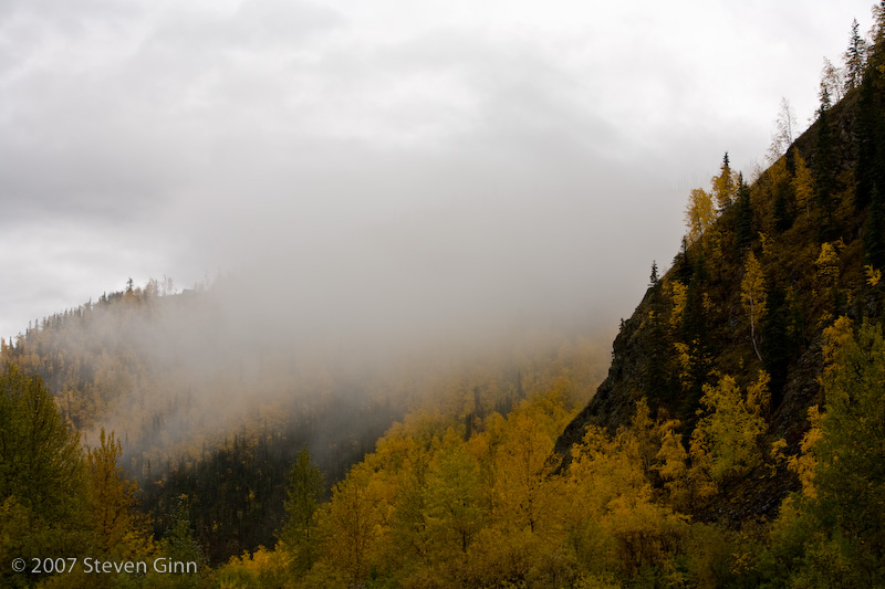
Here is a photo of a fall scene right next to our campground this morning.
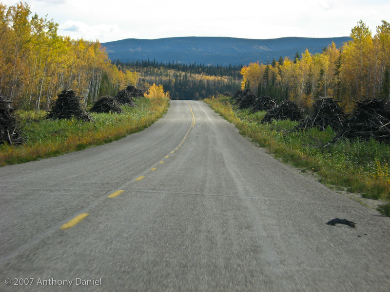
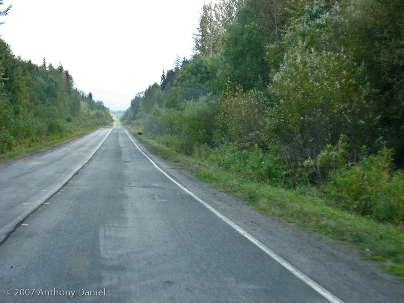
A road shot along the way down the Klondike Highway. I thought it was interesting that they had cut down the trees next to the road but had not removed the debris.
We had considered diverting and taking the Campbell Highway east and then down directly to Watson Lake but our expectation was that it would be a lot of gravel and would take longer. We decided that we wanted to take some extra time and come down through the Jasper and Banff region on our way back to Washington, so saving some time here by not doing the Campbell Highway made some sense.
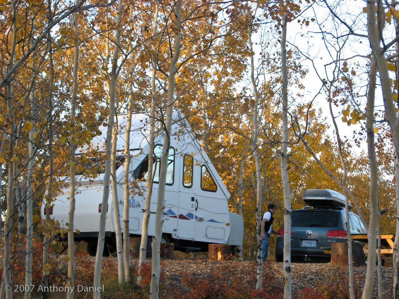
Here is our camp for this evening.
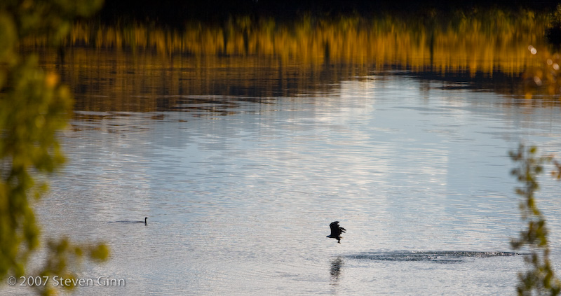
One interesting part of today was when we were setting up camp we noticed that a bald eagle fishing in the lake. So we stopped setting up and took some photos. The eagle below has a fish in it's talons. It was funny to see the other birds in the lake sound an alarm and then dive underwater when the eagle would get close.
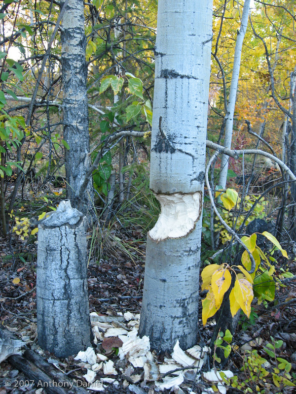
Tony found the beavers had been doing a little logging near our camp.
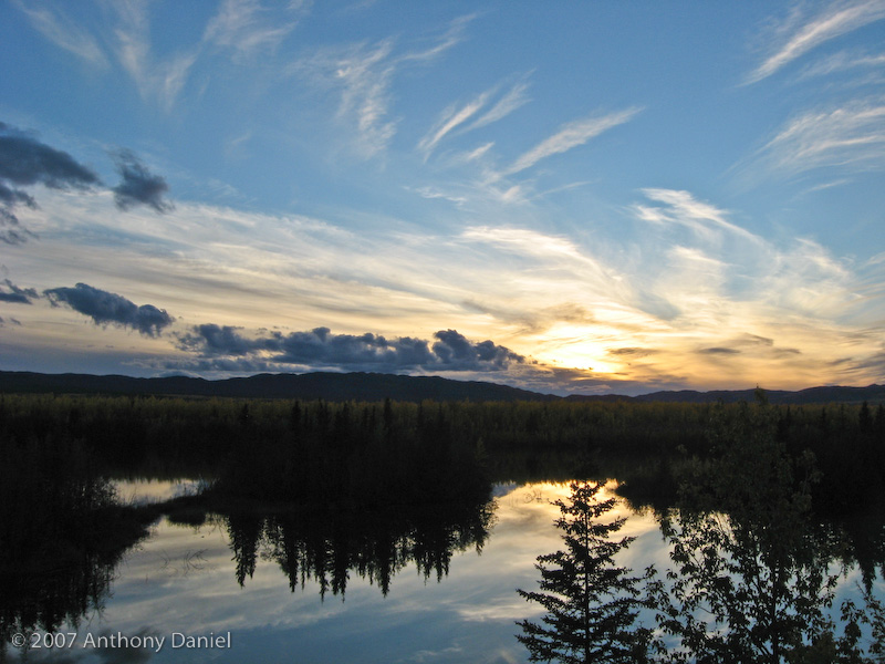
Tony also took a nice sunset shot this evening.
Our plan for tomorrow is to make it to the north end of the Cassier Highway and start down it the following day.
Today was basically a travel day. The weather was overcast all day and after we reached Whitehorse and the Alaska Highway we were retracing a path that we had done on the way up.
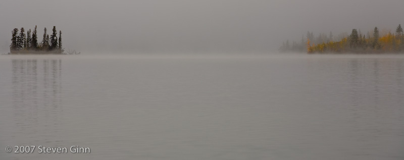
Here is a scene this morning looking out across the lake from our campsite.
We decided to stay in Wilson Lake today for internet access and then tomorrow we'll backtrack about 10 miles and take the Cassier Highway (Hwy 37) south. This will give us several days of new road. The next place we'll see that we saw on the way up will be Prince George.
On our way into Wilson River we were met and greeted on the edge of town by the Royal Canadian Mounted Police (RCMP) who had a road block setup and wanted to check our "papers" and our sobriety. Fortunately both our papers and sobriety were in order. Although, the guys in the pickup going the other way didn't seem to be in as good a shape since they were having to get out of their truck.
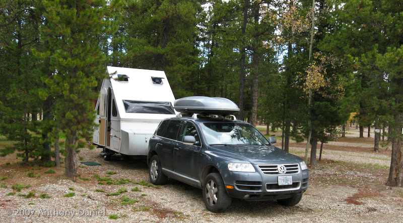
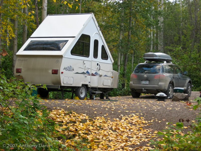
Here is a photo of tonight's camp.
Tomorrow we head south on the Cassier Highway which will be new road we have not seen before.
Today was also pretty much a travel day. Our goal was to get about halfway down the Cassier Highway, which we accomplished.
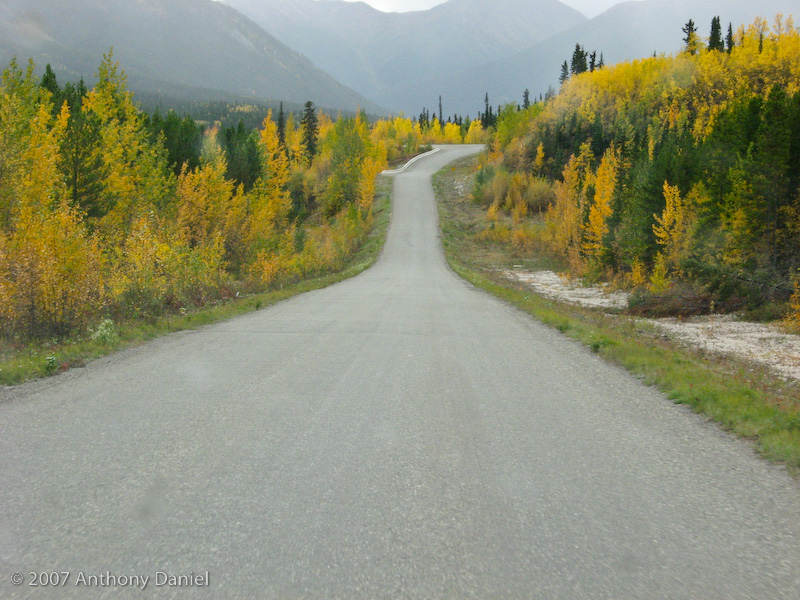
The drive was interesting. The road was a little narrow and sometimes rough but the other traffic was minimal so it all went by pleasantly. Here is a typical shot of the road.
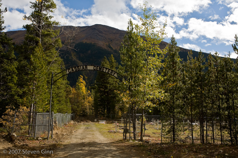
Other than the feeling of taking a drive in the middle of nowhere there was not that much that happened on the drive. We made a couple of stops, the first was at the Cassier Cemetery. It was a strange little place out in the middle of nowhere.
The second stop was a Jade shop. It turns out that about 75% of all the Jade in the world is mined out of the mountains near the Cassier Highway (at least according to the Jade shop).
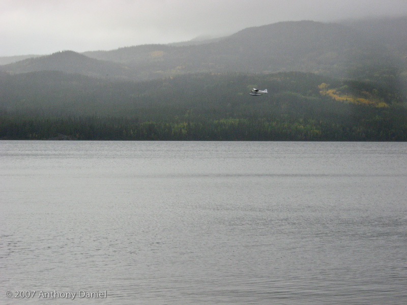
The only notable thing about our campsite tonight is that a float plan keeps taking off and landing on the lake.
Here is a shot of our camp tonight.
Tomorrow our plan is to complete the Cassier Highway and turn east towards Prince George on Hwy 16 (Yellowhead Highway) and camp somewhere along the way.
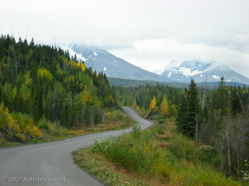
The rest of the drive down Cassier Highway was more scenic than yeasterday as the landscape changed to a warmer and wetter climate. Here is a typical scene from the drive.
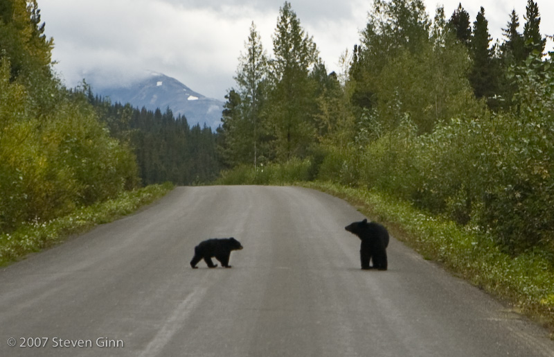
Today turned out to be "bear day". Last nights campground was about halfway down the Cassier Highway. We did not see any bears yesterday but today we saw five bears on the highway in three different sightings. As we drove south, occasionally I would see dark black patches on the shoulder of the highway in front of us.
In the first instance it turned out that it was a mother and her cub. The funny part of it was that the mother decided to walk across the road in front of us and the cub kept eating along the side of the road. The mother stopped in my lane and looked back across the road at the cub. I came to a complete stop because the last thing I wanted to do was to get between the mother and her cub. Not so much because I felt any danger in the car but because I didn't want to accidentally run over the the cub if it tried to rush across the road. Finally the cub joined it's mother and they went off the side of the road.
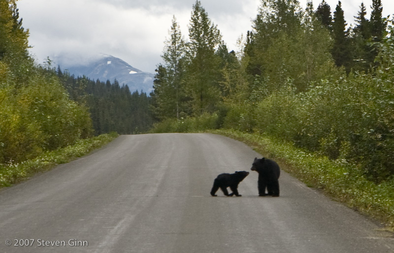
The second instance was also a mother and a cub. This time they didn't cross the road but did run away from the shoulder up into the brush. The cub is behind the mother and is not visible in this photo.
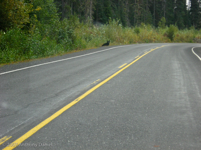
In the third instance we simply saw a large black bear cross the road in front of us, far enough away that we did not even slow down.
Above I said that we saw five bears on the Cassier Highway. Actually we saw six bears today. As we drove into the campground, ten miles or so east of Smithers, BC on the Yellowhead Highway, we saw a big black bear running down a road a few yards from the entrance to to campground. We did not get any photos of it because it was a complete surprise to see it and we did not have time to even touch a camera. According to the camp host the last time the bear was spotted was about two weeks ago. The host did not seem happy that we saw it because it turns out that he is staying only a few hundred yards from were the bear was.
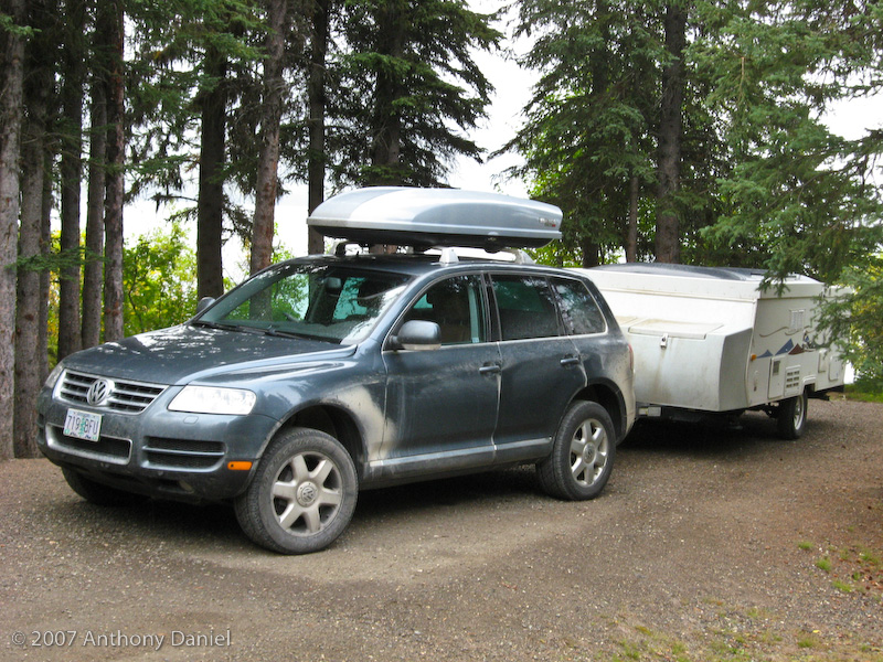
Here is tonight's camp. Note how much dirtier we are. Several parts of the highway today were gravel and it had rained so we picked up a lot of mud. A lot of it washed off during rain on the paved sections of road but the end result was a hard brown protective coating on both the trailer and the Touareg.
Tomorrow our plan is to reach Prince George and camp someplace that has wireless internet. From Prince George instead of turning south towards home we are going to continue east towards Jasper.
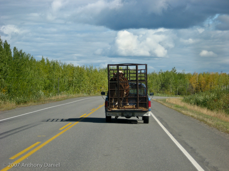
There is really not much to say about today's drive. The Yellowhead Highway is a well traveled road with lots of towns and farms along it. One interesting event was this pickup that was rocking severely every time the cow moved.
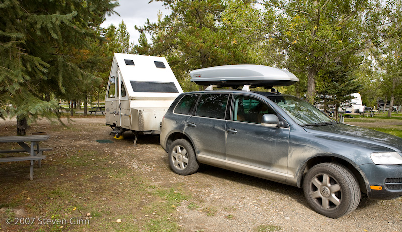
Here is tonight's camp.
Tomorrow the plan is to head east towards Jasper.