2007 Alaska Road Trip |
 |
 |
 |
 |
 |
We started the day in rainy Anchorage and headed east on Glenn Highway. Since the start of the trip I have heard that Denali Highway was worth a drive. So our plan was to head east on Glenn Highway then north on Richardson Highway and then head in west on Denali Highway about 20 miles until the pavement ends and the road turns to gravel. From there Denali Highway is all gravel until it intersects with Parks Highway by Denali National park. Before the Parks Highway was built in 1971 between Fairbanks and Anchorage the only way to get to Denali was to go down or up the Richardson Highway and drive west on the Denali Highway.
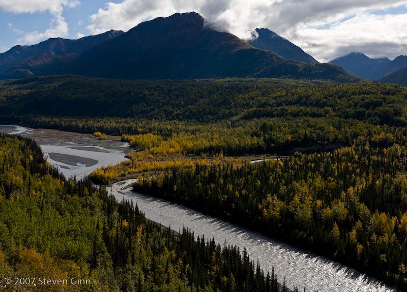
The drive east on Glenn Highway was spectacular with all the fall foliage out. It was a much more scenic drive than I had anticipated.
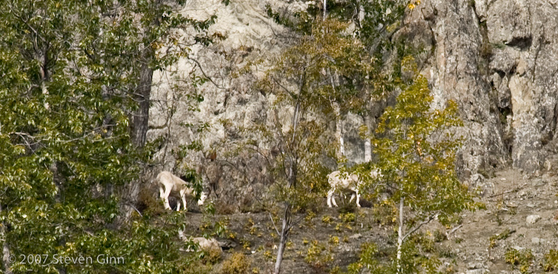
Here are some sheep, or may goats, we saw "way" up on the cliff side along the Glenn Highway. This photo is cropped significantly so the sheep show up.
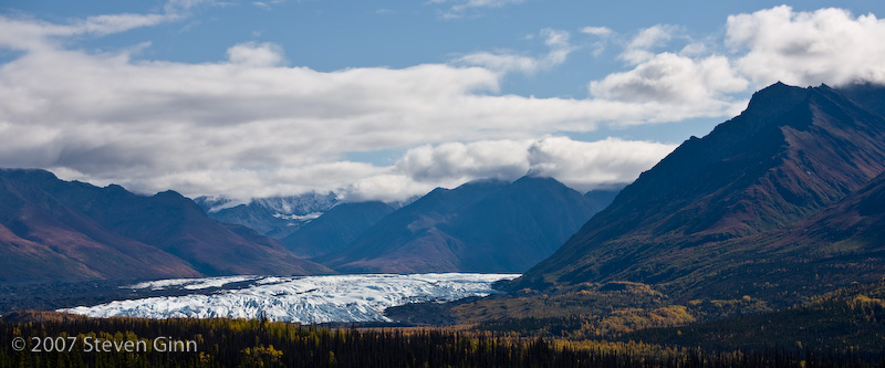
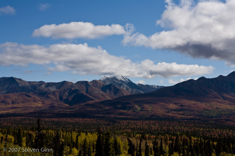
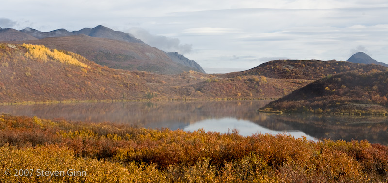
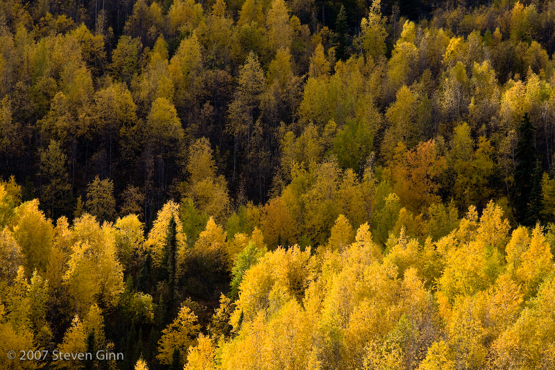
The trees, mountains and clouds all made a great image here.
The drive west on Denali reminded me a lot of parts of the Dalton Highway and of parts of my trip in Iceland. All the trees had disappeared and it was tundra as far as the eye could see. We saw a lot of hunters as well.
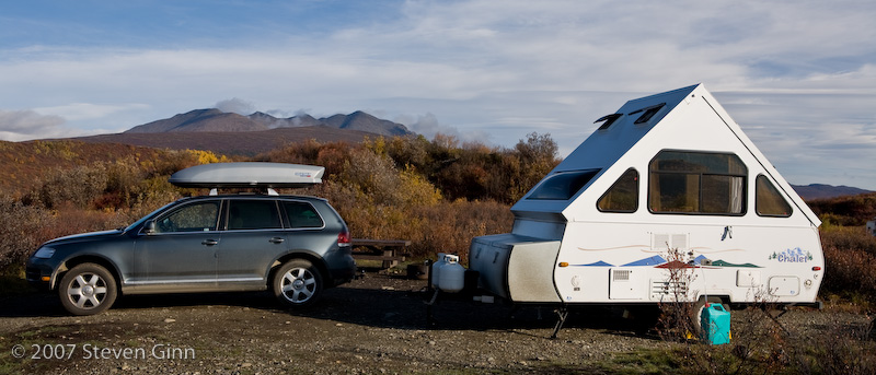
The BLM campground we are staying at is just shortly after the paved road turns to gravel and next to a nice lake. Interestingly enough despite being a developed BLM campground there is no fee to stay here. However, we are surrounded by Hunters and their ATV's.
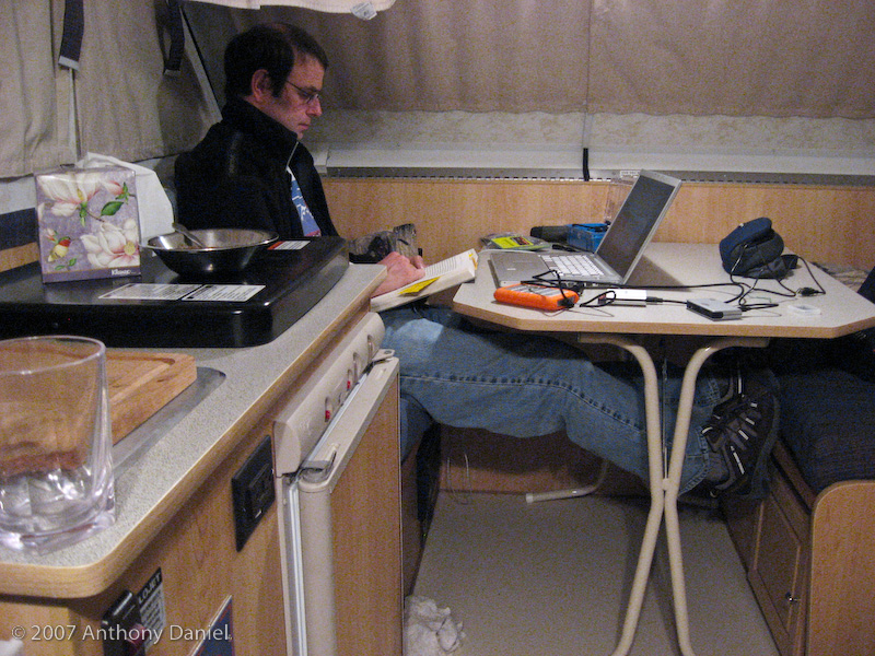
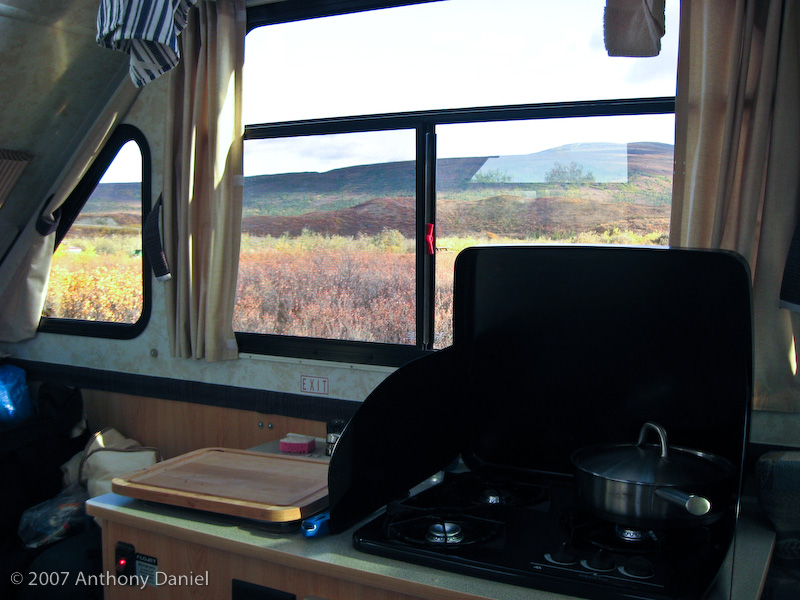
Here is a shot from inside the trailer.
Here is the outside camp shot.
For me this spot feels like we are really starting to head back. Tomorrow we will head back to Tok, via the Tok Cutoff highway, and once we reach Tok our plan is to make a decision on if we are going to continue north on the Taylor and Top of the World Highways as an alternate way back into Canada or if we are just going to retrace our steps down the Alaska Highway.
We woke up to some very thick low fog, you could not see more than a couple hundred feet. It then cleared up to a beautiful clear blue day before we left camp.
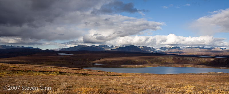
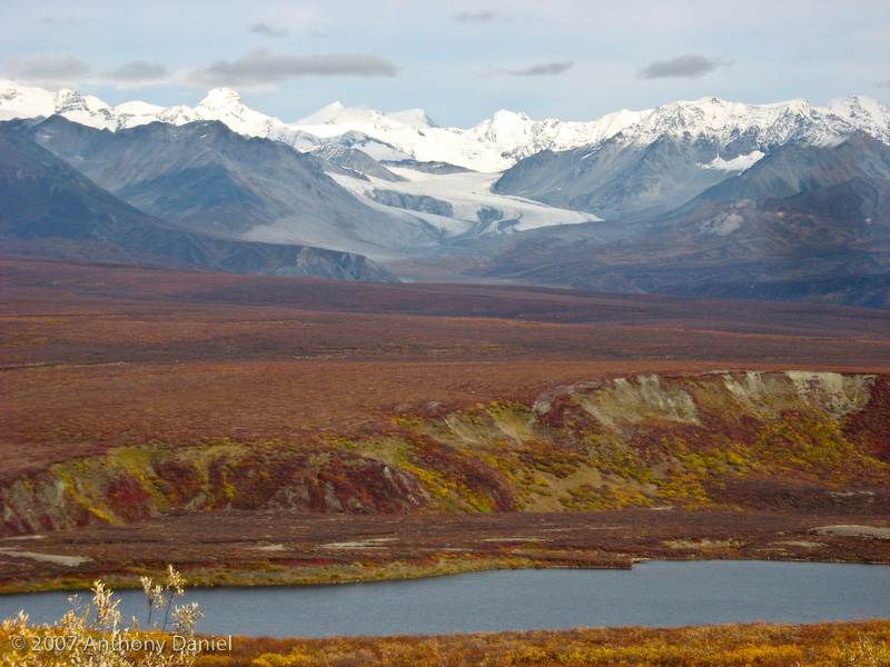
Here is a morning shot of Tangle lake next to camp.
The drive back east on the Denali Highway was very pleasant except that I would say it is probably the roughest paved road we have been on. The rolling bumps, probably due to frost heaves, in the road were constant.
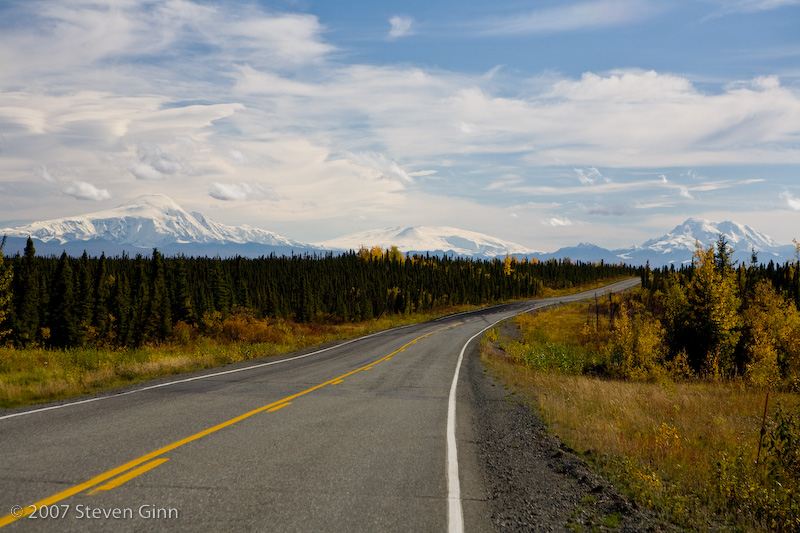
Here is another shot from along Denali highway on our way back out.
Once we made it back to the Richardson Highway we headed south and then northeast on Tok Cutoff road. The drive on the Tok Cutoff highway was beautiful with all the fall colors and Wrangel-St. Elias National Park off to our right.
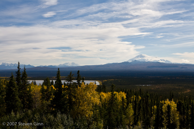
Here is a shot of Wrangel-St. Elias National Park from the Richardson Highway as we head south for the Tok Cutoff Highway where we took a left to skirt the northwest side of the park.
Here is a shot of the park from along the Tok Cutoff Highway.
Here was a great fall colors shot along the Tok Highway.
When we reached Tok we re-fueled and looked at the weather and decided that we would go ahead and take the Taylor Highway northeast up by Chicken Alaska then the Top of the World Highway to Dawson City Yukon and back down to Whitehorse on the Klondike Highway.
Tonight we are camped at the West Fork Campground which is in the Fortymile River region just south of Chicken Alaska. Neither Tony or I remembered to take a photo of the camp. We did spent sometime talking with the camp host and discovered that the BLM buys water and trucks it in for the potable water in the campgrounds along this highway and they also buy firewood which is given away free for use in the campground. Your tax dollars at work!
Tomorrow our goal is to cross the border and spend the night in Dawson City in the Yukon.
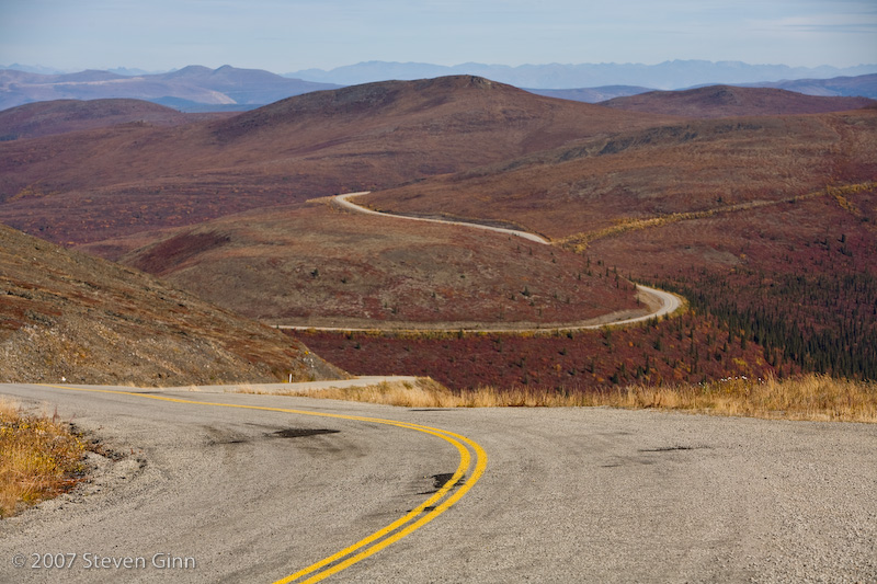
Today was a beautiful drive across the Top of the World Highway from Chicken to Dawson City. The road really does feel like you are driving across the top of the world and with the added bonus of all the fall colors and bright sunshine the scenery was outstanding. About 20% of the drive was on gravel road.
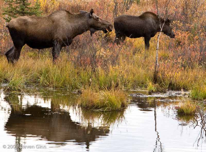
Early in the drove we saw these Moose along side the road.
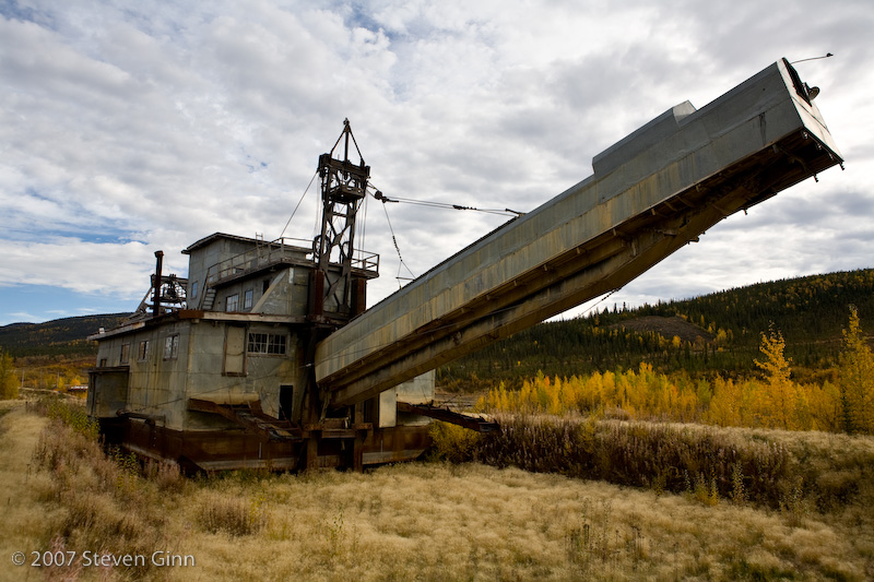
Here is an old gold mining dredge, we drove by another one just like this that was being actively demolished by an excavator as we went by.
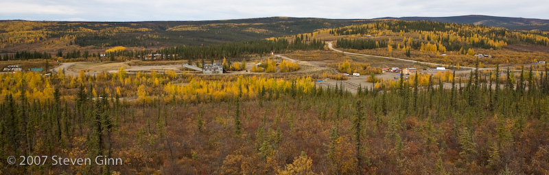
Here is a photo of the entire town of Chicken from the hill as we drove out of town. Note the same dredge as above in the middle of town.
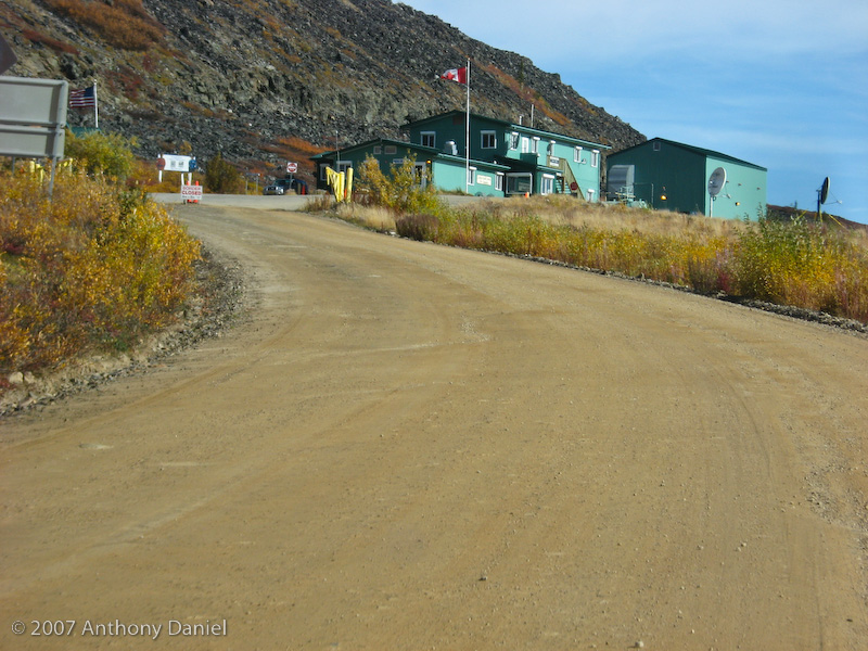
We crossed the border into Canada at a very remote site but with no problems. There was no line to cross the border. It was a little unnerving to drive up and see the sign in the middle of the road that said "Border Closed" but then when you get there and read the fine print under it you see it also says "between 8pm and 8am". I think the information we had was the it was suppose be open until 9pm but fortunately we were crossing in mid-day.
Once we crossed the border the road changed from gravel back to pavement. Here is a shot looking east at the Top of the World Highway just past the border.
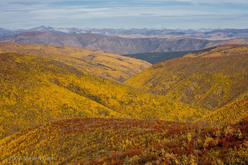
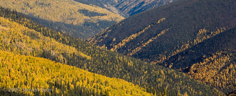
Here are a couple of shots, both looking north, from along the way towards Dawson City.
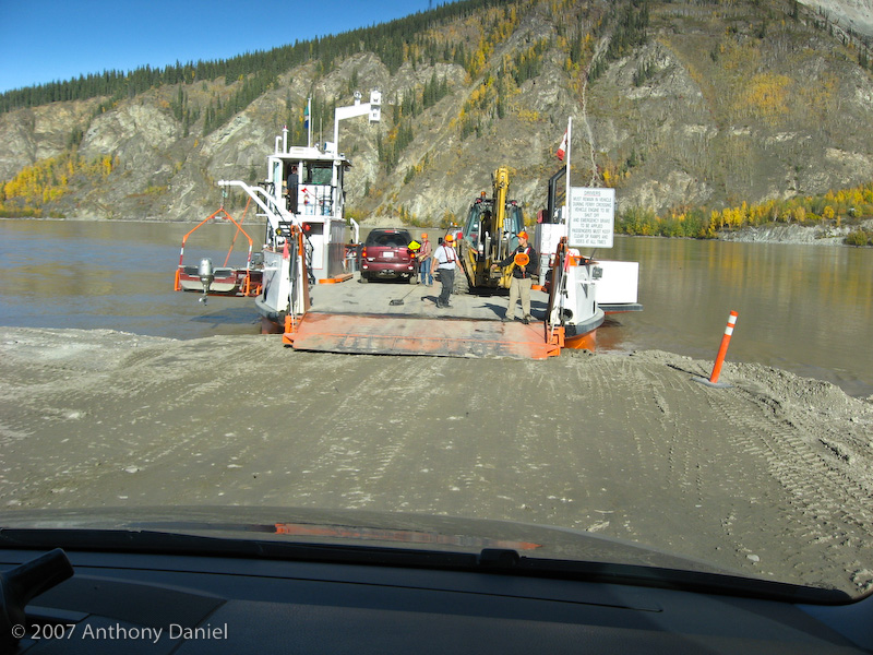
The last bit of the drive was interesting in it's own way. The road came down a hill and we could see Dawson City at the bottom, however, the Yukon river was between us and Dawson City. At the bottom of the hill it turned out that the way across was by a small ferry. I found it interesting that the ferry just beached itself on the river bank for us to load. Here is a shot as we squeezed onto the ferry.
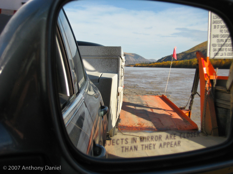
Here is a shot looking back that shows our back trailer wheel just on the ferry's deck and I'm sure the rest of the trailer is hanging out over the loading ramp. To get that far on I was practically touching the car in front of me.
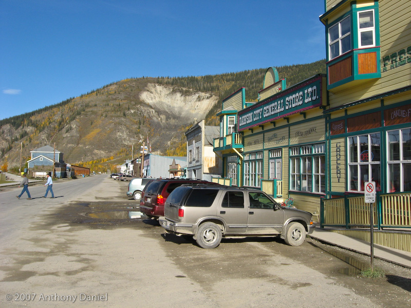
Here is a shot of the main street through Dawson City. It was the only paved street in town. All the streets had boardwalks for sidewalks.
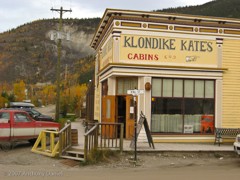
Tonight we ate at Klondike Kate's in town, it was one of the few places that seemed to be open. Most of the town is closing down for the winter, some of the places we saw were actively boarding up their buildings.
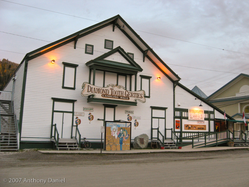
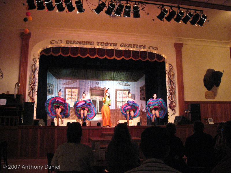
After dinner we went over to the oldest casino in Canada (until the 1990's it was the only one) and enjoyed a short show.
Here is a shot of the show. The gambling tables are behind and to the left from the perspective of this photo.
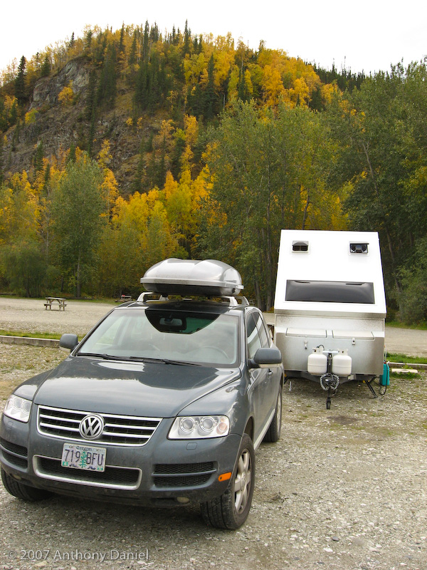
Here is our camp tonight.
Here I am inside the trailer importing from Tony's and my cameras all 800 photos to be evaluated for inclusion in this journal entry. Just that step takes a while so I was reading a book while the computer worked.