2007 Alaska Road Trip |
 |
 |
 |
 |
 |
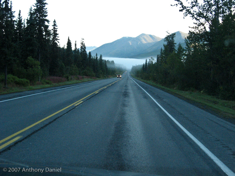
We got up early today to get Tony to Whittier to catch his ferry. The drive was nice with some patches of fog along the way.
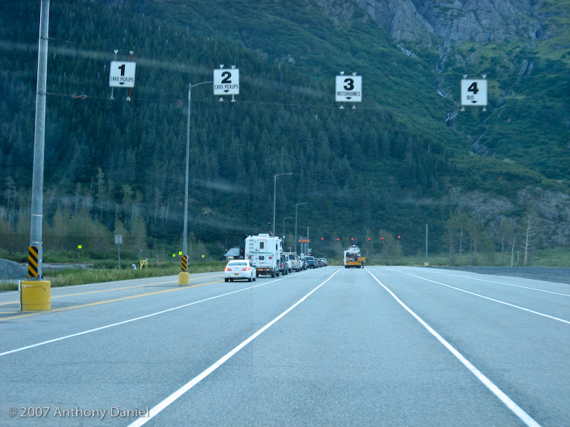
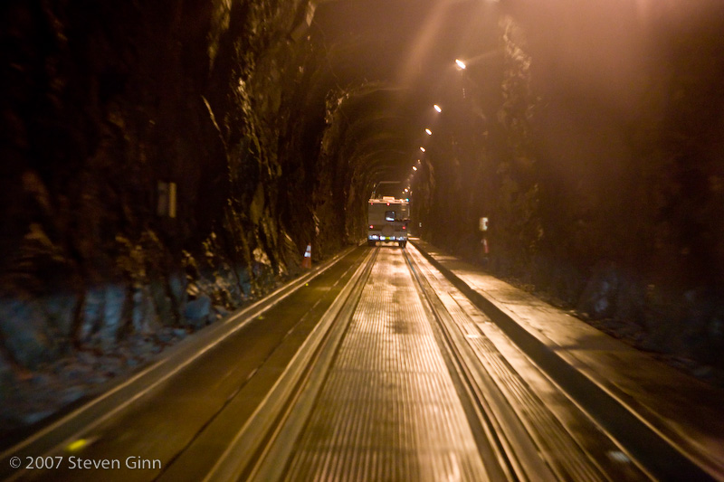
The last part of the drive turned out to be a lot of fun. The last 2.5 miles to Whittier goes through a 2.5 mile long, one way, railroad tunnel. On each end of the tunnel there is a staging area just like you have for ferries and every half hour the traffic in the tunnel switches directions. In addition the train still uses the tunnel as well. The tunnel is very narrow, so the result is that you have to drive on top of the tracks all the way through the tunnel. This tunnel is almost as much fun as the one that Rusty and I drove through in Iceland where you simply play chicken, there you drive through and occasionally there are pullouts that a car is suppose to stop in to allow the oncoming traffic to pass.
Here is photo of the staging area for the tunnel.
Here is a photo of the tunnel entrance.
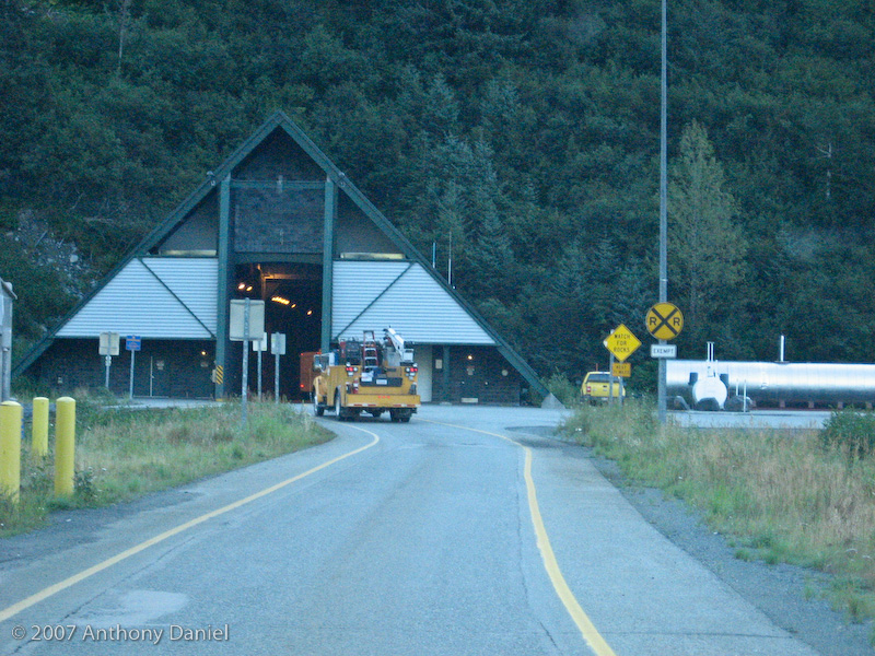
Unfortunately Tony's camera was not able to get a clear photo of the inside of the tunnel. When I pick Tony and we come out through the tunnel we will try with my camera. There is no way to stop in the tunnel for me to take a photo.
We managed to get Tony to the ferry well ahead of time but I left him even before the ferry arrived so that I could catch the next scheduled outward bound leg through the tunnel. I am suppose to be back to pick him up two days from now on Saturday at 11:45am. Click here to see this part of the trip for Tony.
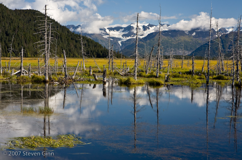
Not far from the turn off for Whittier was a stand of dead trees I had seen when we drove by. After getting back out of the tunnel I went looking for it again. It was a bit of a hike down a railroad track to get the photo I was interested in but here it is.
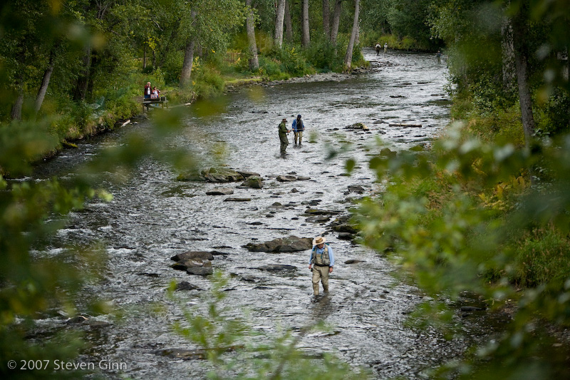
The rest of the day was an interesting drive down to Homer along the Sterling Highway. Some of the rivers along this route are clearly "very" popular with fisherman, I could see lots of fly fishermen standing in rivers.
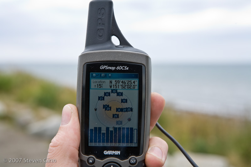
The end of the Sterling Highway could be called the "End of the Road" since this road goes the farthest west that you can go on the North American road system without taking a ferry. The road actually ends on Homer Spit but it turns out that the farthest west point is actually a few miles north of that at Anchor Point. Here is a shot at the farthest west point I could find to drive to.
Here is the photo of the GPS to prove it.
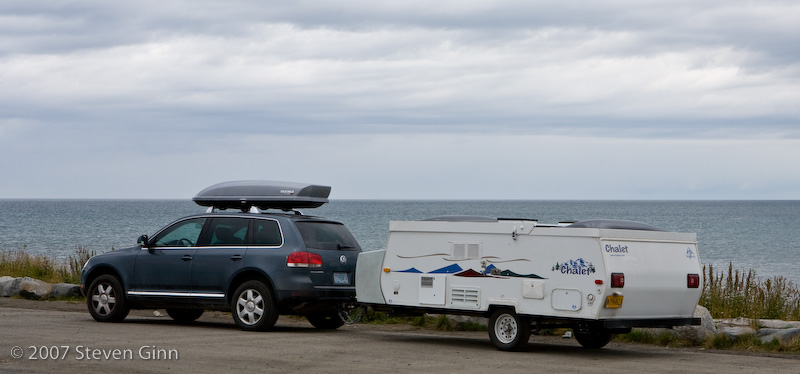
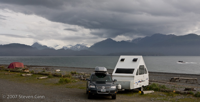
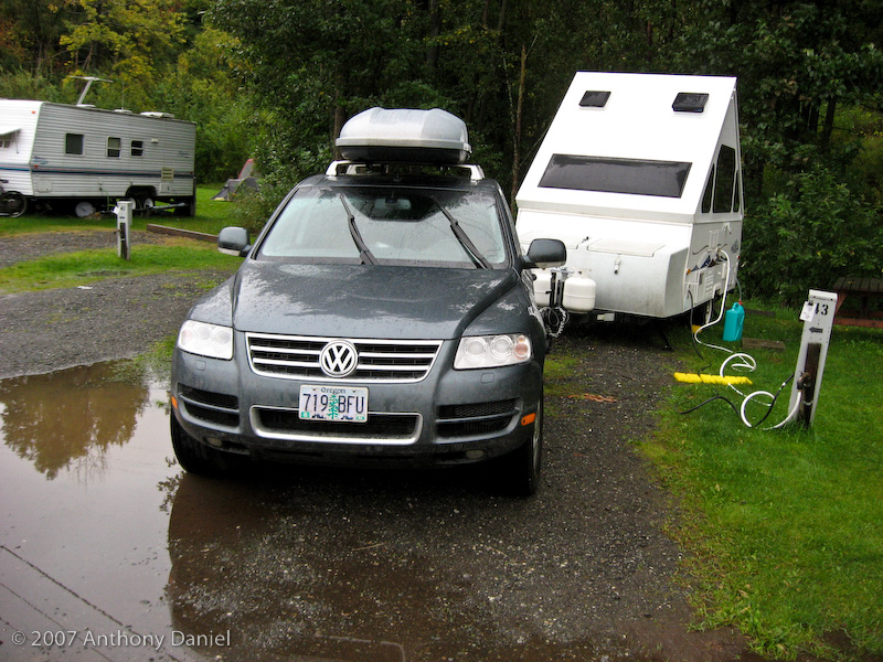
I decided to spend the night at one of the campgrounds on Homer Spit which is a 2.5 mile long spit off of Homer that seems to be dedicated to fishing and tourism. I found the farthest out campground I could, called Homer Spit Campground, which turns out to be one of the older ones. There were other fancier ones closer to the mainland but I didn't think their views were as nice. I selected to have one of the sites right down on the beach so I had a clear unobstructed view of the sun setting over the water. Here is a photo of my campsite.
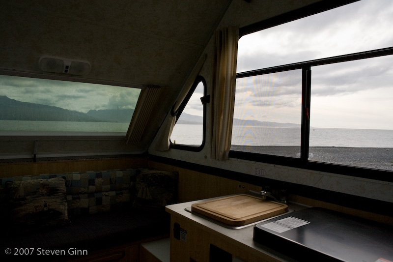
Here is a shot of part of the view from inside the trailer.
It was a very nice place to camp and it was walking distance from these tourist shops.
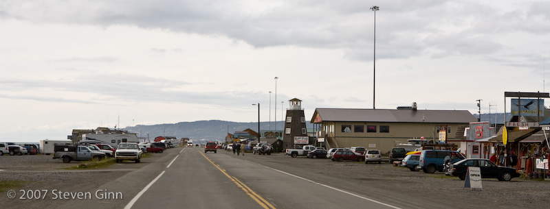
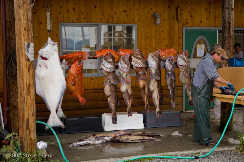
Here are some of the fish that people were catching.
Tomorrow my plan is to head back towards Whittier some so that I don't have to get up too early for my drive Saturday morning to pick Tony up.
I have heard several times that on the Russian River the fishermen and the bears fish along side of each other. So I decided that I wanted to go bear hunting and the Russian River Campground seemed like a perfect place to spend the night on my way back towards Whittier.
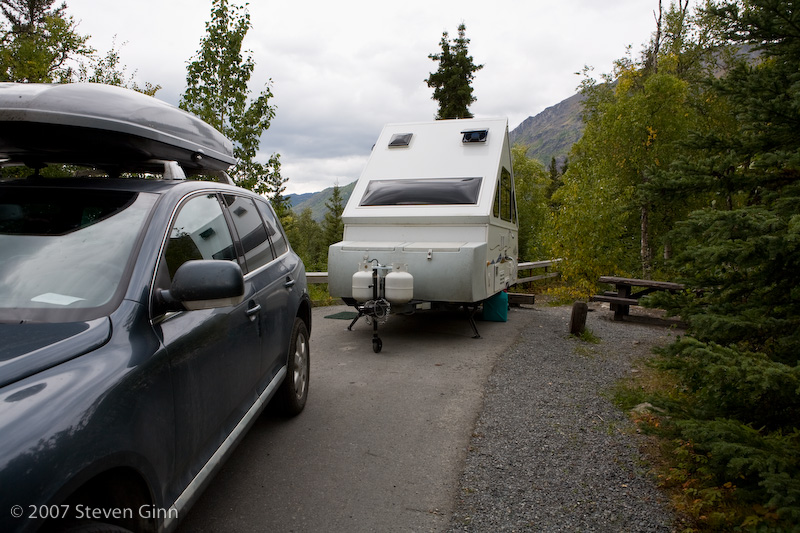
After a relaxed morning on Homer Spit I packed up and drove back up the Sterling Highway to the Russian River Campground. It is a nice campground with lots of bear warning signs. Here is a picture of my camp, notice that even the campsites here are paved. This campground is heavily used by fishermen.
After setting up camp I grabbed the camera and hiked down to the river to look for bears. This area is so heavily used that they have put board walks along the bank and parts of the bank are fenced off to allow it to recover.
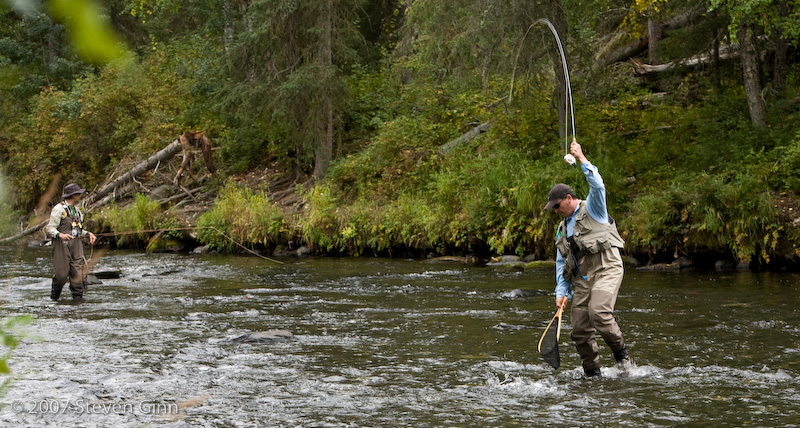
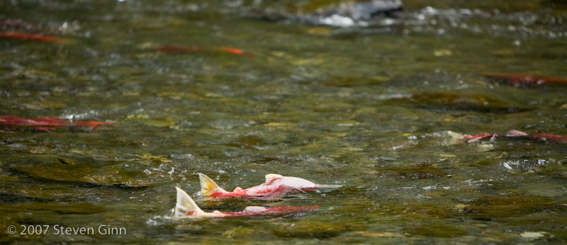
There are lots fisherman trying to catch both trout and Sockeye salmon that are spawning in the stream. I walked for miles along the river bank all the way down to the mouth of the Russian River where it meets the Kenai River and back up river for a half mile or so above the campground. I met lots of fishermen, some of them armed, and heard repeatedly that they had been seeing at least three bears in the area. I kept getting conflicting advice on which way to go to find the bears. Unfortunately I was unable to spot any this afternoon. My guess is that there were too many fishermen around. So instead here is a few shots of fishermen and some spawning Sockeye salmon.
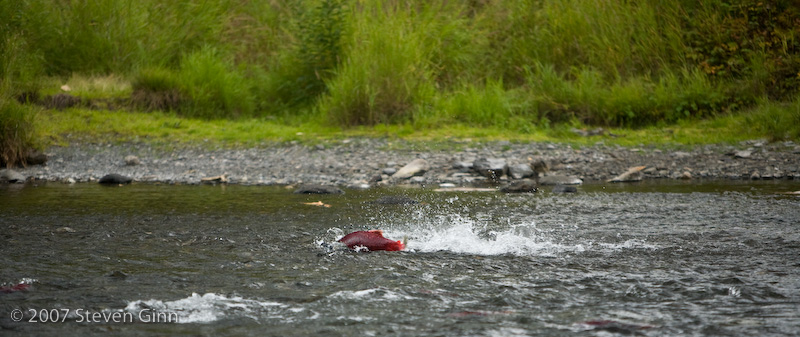
Here is a photo of someone actually catching a fish, unfortunately the fish broken the line before he was able to pull it in. The fisherman told me that he was sorry he was not able to pull it in to make a good photo.
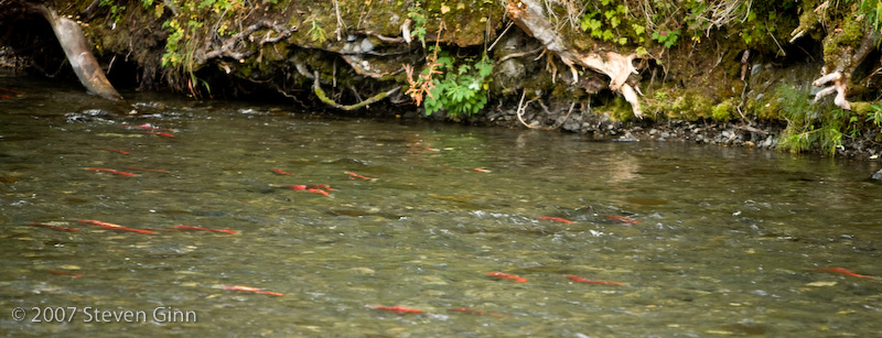
Here is what most of the river looked like with thousands of red Sockeye salmon swimming in it.
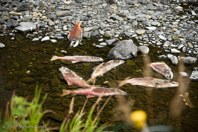
Then of course there were those fish that were already done. It is not clear to me what condition the fish were in that the fishermen were catching. I had thought that by time salmon reached their spawning grounds they where not that good to eat.
However, as you can see, from a fishing perspective the fishermen were practically shoulder to shoulder.
Tomorrow I head back to Whittier to pick up Tony. His ferry is scheduled to arrive at 11:45am so I am planning to make the 11:30 am inbound schedule at the tunnel.
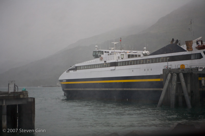
I ended up cutting it closer than I had planned to get to the Whittier tunnel, after I got going I ran into a fairly large bike ride on the Seward Highway. The end result was that I made it into the tunnel with 2 minutes to spare before they closed down the inbound traffic. If I had missed it Tony would have had to wait an hour for me to pick him up. As it worked out his ferry arrived just as I got there. Here is his ferry arriving and backing into the dock. Again click here to see Tony's write up on his trip.
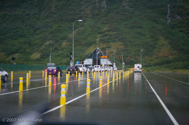
Today was a bit rainy as you can tell from this shot of the outbound tunnel staging area.
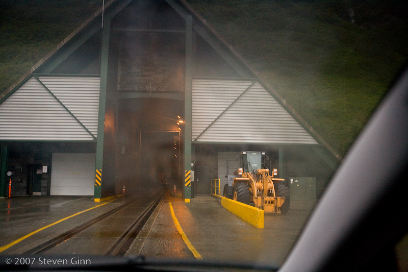
Here is a shot as we approach the tunnel.
Here is inside the tunnel. The speed limit is 25mph and you are suppose to maintain 100 feet or more between cars.
Once we made it out of the tunnel we turned north and drove to Anchorage and in the pouring rain we checked into a small RV park near downtown.
Our plan is to spend two nights and spend some time touring Anchorage. Unfortunately it is pouring down rain outside right now and we got very wet setting up camp. Fortunately, it is nice and warm and dry inside the trailer.
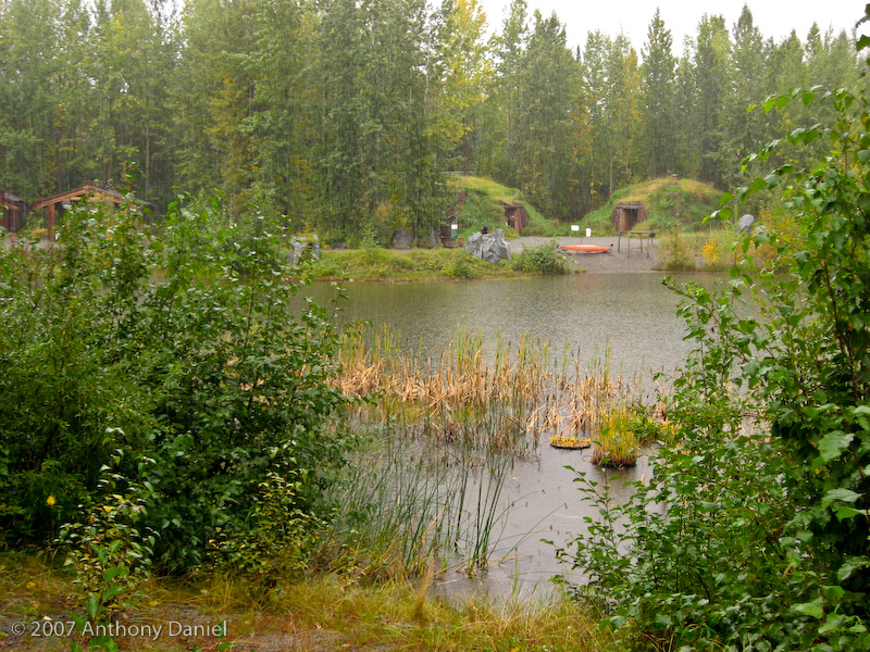
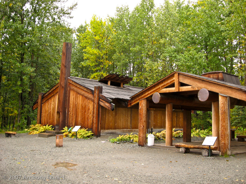
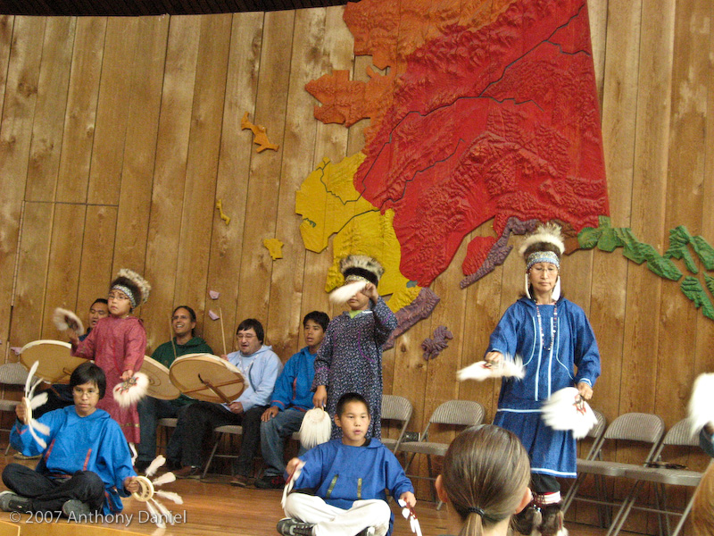
We spent time in Anchorage today. The main place we visited was the Alaska Native Heritage Center. It was a fairly impressive exhibit with re-creations of native buildings and a native dance show.
Here are some of the outdoor exhibits showing the traditional native buildings. The turf buildings shown below would traditionally be half underground but for the exhibit they built them above ground for ease of tourist access.
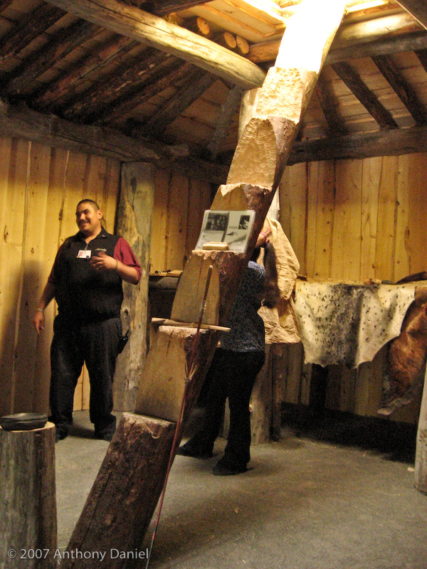
As mentioned above some of the buildings are traditionally built partly underground to help keep the heat in so some have exits through the roof. Although I believe these exits were only used in the summer, for the winter tunnels were used to help trap the warm air inside. It was also interesting to learn that for the northern natives their only source of wood was driftwood.
For some of the more southern natives the cold was not as much of a problem as rain and they also had a "lot" more wood.
Inside the heritage center we saw a native song and dance demonstration. The colors on the map in the background represent the areas for the different tribes.
We also did some shopping and went out for a nice meal. Despite looking for the nicest restaurant we could find and having a full meal the best we could do was a $100 meal, which does not come anywhere close to the $400 meals Rusty and I were having in Iceland.
Tomorrow we start heading back towards Canada.